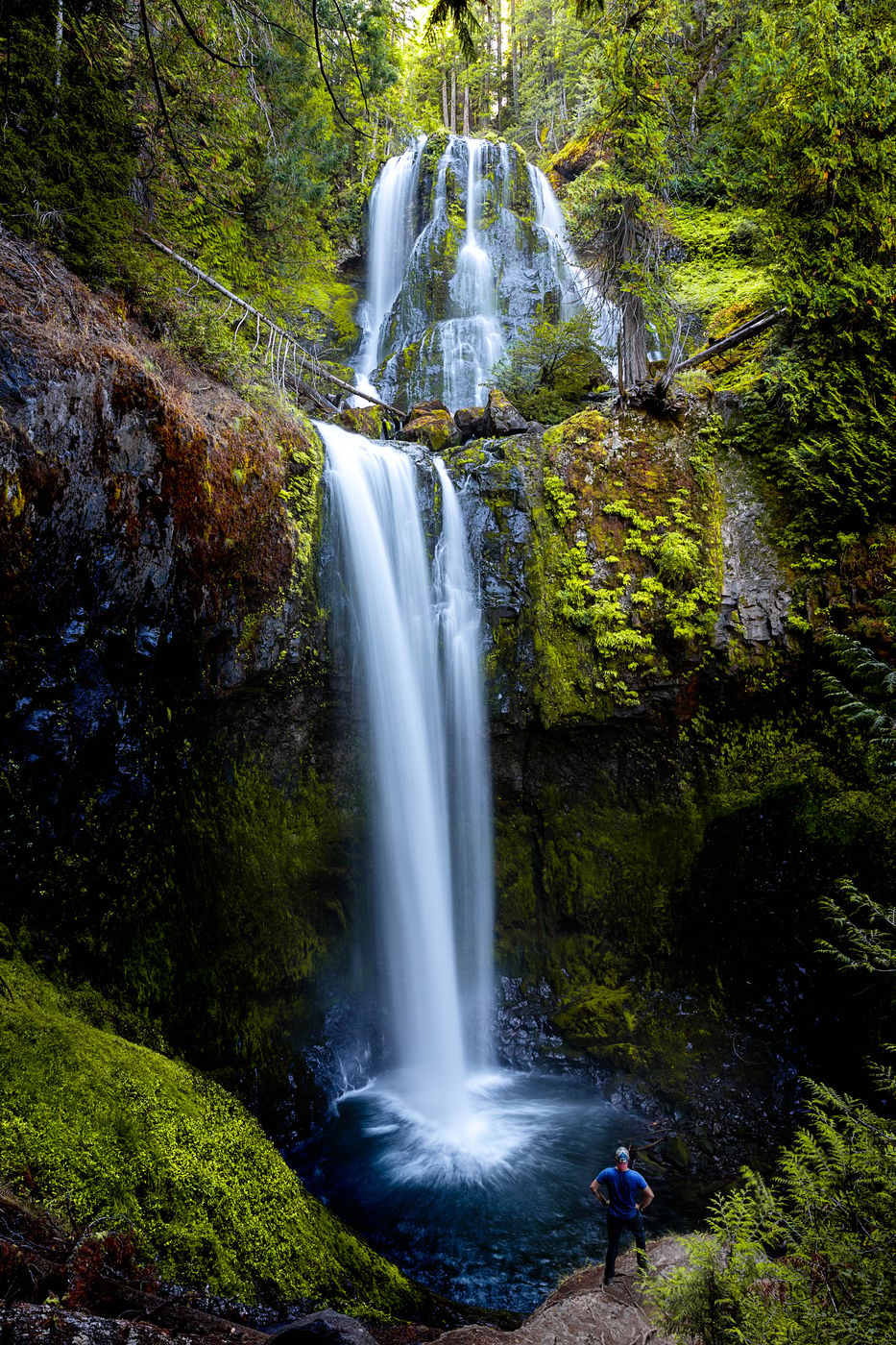

USA Falls Creek Falls
This easy, 3.4-mile, out-and-back hike along beautiful Falls Creek leads to one of southern Washington’s highest waterfalls, 335-foot Falls Creek Falls. The hike gains 750 feet in elevation.
Travel Information
From SR 14 at the Bridge of the Gods (tolls are required on the bridge), drive 5.9 miles east on SR 14 to Wind River Road. Turn left; in 8.5 miles pass through the community of Stabler. Drive another 5.7 miles and come to a Y intersection; Government Mineral Springs Road is the left fork. Take the right fork, Wind River Road/NF 30, drive 0.7 mile to NF 3062, and turn right.
The route from the start of NF 3062 to the trailhead is 2.4 miles, as follows: On 3062, keep left on 3062 where NF 055 comes in on the right; keep left on 3062 where NF 056 comes in on the right. In another 0.9 mile, turn right on FR 057, which leads to the trailhead parking area.
The route from the start of NF 3062 to the trailhead is 2.4 miles, as follows: On 3062, keep left on 3062 where NF 055 comes in on the right; keep left on 3062 where NF 056 comes in on the right. In another 0.9 mile, turn right on FR 057, which leads to the trailhead parking area.
Spot Type
Outdoor
Crowd Factor
A decent amount of people
Best Timing
Sunrise in summer
Sunrise & Sunset
05:35 - 20:52
| current local time: 15:09
Photo Themes
backpacking
Backwaters
Landscape
Waterfall
Locations
Washington State
fall creek falls state park


Spot comments (0)