

USA Sutter Buttes from Pass Road
The Sutter Buttes are sometimes called “The World’s Smallest Mountain Range.” In reality, the buttes are, to quote Wikipedia, “a small circular complex of eroded volcanic lava domes which rise as buttes above the flat plains of the Sacramento Valley in Sutter County, Northern California. They are situated just outside Yuba City in the northern part of the state’s Central Valley.”
The buttes have few roads and most of the land is private. In addition, the state park is not currently open to visitors. However, guided hiking in the buttes is possible, although I have never done it. Contact Middle Mountain Hikes (website below).
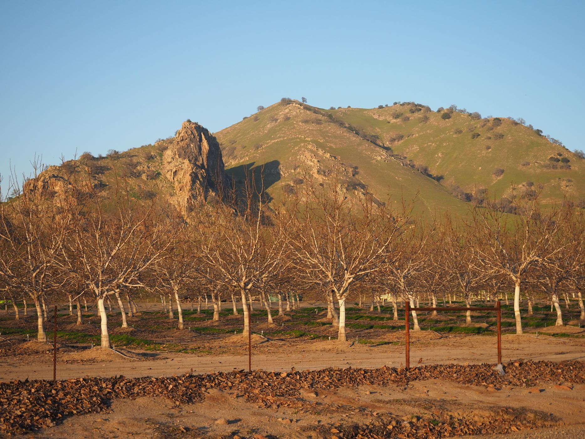
The only road that goes through Sutter Buttes is called Pass Road and it passes through an east-west oriented valley in the southern third of the buttes. I made these two images along Pass Road looking north toward the buttes. You can also drive around the perimeter of the buttes.
Also, there are several wildlife refuges in the vicinity of the buttes that support large number of birds and other animals.
The buttes have few roads and most of the land is private. In addition, the state park is not currently open to visitors. However, guided hiking in the buttes is possible, although I have never done it. Contact Middle Mountain Hikes (website below).
The only road that goes through Sutter Buttes is called Pass Road and it passes through an east-west oriented valley in the southern third of the buttes. I made these two images along Pass Road looking north toward the buttes. You can also drive around the perimeter of the buttes.
Also, there are several wildlife refuges in the vicinity of the buttes that support large number of birds and other animals.
Photography Tips
This is landscape photography involving rolling hills and short peaks. From mid-Winter* to late-Spring, the hills will be green. In Summer and Fall, the hills will be mostly brown. There are some orchards along Pass Road (almonds, perhaps?) and pastures with grazing cattle.
* These two images are dated January 26, 2022. The hills greened up quite nicely this year due to heavy rainfall in December 2021. Snow is possible at the tops of the buttes, but it doesn’t occur every winter. Dense Tule Fog is possible in the winter. The fog can enhance some photographs, but it can also be hazardous to drive in.
* These two images are dated January 26, 2022. The hills greened up quite nicely this year due to heavy rainfall in December 2021. Snow is possible at the tops of the buttes, but it doesn’t occur every winter. Dense Tule Fog is possible in the winter. The fog can enhance some photographs, but it can also be hazardous to drive in.
Travel Information
From the intersection of State Route 99 and State Route 20 in Yuba City, take SR 20 west 6.5 miles (10.5 km) and turn right (north) onto Acacia Avenue. Along Acacia Avenue, from about 1.0 to 2.0 miles (1.6 to 3.2 km) north of SR 20, pass through the small town of Sutter. At the north end of the town, Acacia Avenue bends to the left (northwest) to become Pass Road. After another 1.5 miles (2.6 km) of gently curving road, Pass Road again bends to the left into an alignment that is mostly east-west for the next 5.6 miles (9.0 km) to the intersection with West Butte Road, which heads “southish” back to SR 20. About 0.55 mile (0.90 km) west of this intersection, another leg of West Butte Road heads north and connects to other roads that permit driving around the perimeter of the buttes.
The location marked on the map is for the approximate spot where the first image was made, which is due south of South Butte. South Butte is the highest point in the Sutter Buttes (elevation 2,117 feet / 645 m) and it is topped with radio antennas. The second image was made about 2.5 miles (4.0 km) to the west.
For more information about the Sutter Buttes:
https://en.wikipedia.org/wiki/Sutter_Buttes
https://www.parks.ca.gov/?page_id=23786
https://pubs.usgs.gov/fs/2011/3024/fs2011-3024.pdf
https://www.middlemountainhikes.org/
Spot Type
Outdoor
Crowd Factor
Just a few people
Best Timing
Spring
Sunrise & Sunset
05:56 - 20:31
| current local time: 17:46
Photo Themes
Hill
Landscape
Spot comments (0)