
USA Rancheria Falls (Huntington Lake)
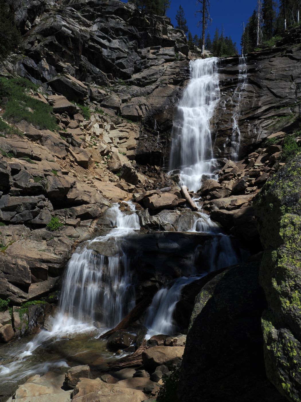
Rancheria Falls is located in California’s Sierra Nevada mountain range, about 50 miles (80 km) northeast of the City of Fresno, near the east end of Huntington Lake. The waterfall is estimated to be 100 to 150 feet (30 to 45 m) tall—opinions vary—and can be reached via a short out-and-back hike. The end of the trail has a small viewpoint at an elevation of about 7,750 feet (2,360 m). It is possible to go past the viewpoint for a closer look, but it may not be safe for some people. On my last visit (June 10, 2026), I did a short, easy scramble on the right-hand side of the viewpoint to get about 10 feet (3 m) higher and 40 feet (12 m) closer.
Please note that California has at least three waterfalls named “Rancheria Falls”: the subject waterfall, another one in Fresno County about 23 miles to the south-southwest (called on some maps “Rancheria Creek Falls), and one in Yosemite National Park. Our Rancheria Falls is by far the easiest to get to.
Please note that California has at least three waterfalls named “Rancheria Falls”: the subject waterfall, another one in Fresno County about 23 miles to the south-southwest (called on some maps “Rancheria Creek Falls), and one in Yosemite National Park. Our Rancheria Falls is by far the easiest to get to.
Photography Tips
Rancheria Falls is tucked into a narrow, steep canyon. The falls face northwest, so it gets pretty good sunlight in the afternoon, especially each side of the summer solstice.
I shot this photograph on June 10, 2026, at 2:48 p.m., PDT. I used an OM System OM-1 Mk II and an 8-25 mm f/4 lens at 13 mm (26 mm “full frame” equivalent). I used the camera’s “LiveND” feature with the following settings: f/16, ISO 80, 1/10 s, and ND8(3EV).
Rancheria Falls typically flows strongest in May and June, and it can be a trickle by mid-August.
As I approached the viewpoint, a group of about a dozen people were leaving and I had the waterfall to myself for about half an hour before two more people showed up.
Travel Information
From Fresno, take either SR 168 or Auberry Road (my preference) to the town of Prather, then SR 168 past Shaver Lake to Huntington Lake. The Fresno/Clovis metropolitan area has a population approaching one million people and a well-connected airport.
Prather has several restaurants, one large grocery store, a CVS Pharmacy, two gas stations, and a Sierra National Forest ranger station/information station that is located a very short distance past the traffic circle at the junction of SR 168 and Auberry Road. The town of Shaver Lake has several restaurants, two small markets, and a gas station below the town. Huntington Lake has one restaurant (IIRC) and one small market. There is also a restaurant at the China Peak Mountain Resort (a ski resort above the southeast lobe of Huntington Lake) that I think is open year-round. Both Shaver Lake and Huntington Lake have rental cabins and campgrounds and there are other campgrounds between the lakes and in the surrounding area.
Near the east end of Huntington Lake, about 37.5 road miles (60.4 km) from the traffic circle in Prather, and about 1.1 road miles (1.8 km) past the entrance to China Peak Mountain Resort, turn right onto Bear Butte Road. The trailhead for the Rancheria Falls National Recreation Tail is located at the third switchback, about 1.3 road miles (2.1 km) from SR 168. At the trailhead, there is a small parking lot and a modern pit toilet. This stretch of Bear Butte Road ascends about 465 feet (142 m) at an average grade of nearly 7%. It also used to be paved (and there is some good pavement beyond), but now it’s a bumpy graded road. I have traversed it in a stock 2008 Jeep Grand Cherokee (full 4WD) and a stock 2018 Mazda CX-5 (front-wheel drive), but it’s better in my mid-spec, four-door, 2023 Jeep Wrangler Rubicon.
The Rancheria Fall National Recreation Trail is about 0.8 mile (1.3 km) long, so the round trip is about 1.6 miles (2.6 km). From the trailhead to the viewpoint, the trail has a total ascent of about 300 feet (90 m) and a total descent of about 50 feet (15 m). Reverse these numbers for the hike back to the trailhead. The trail is well-graded and there are spots of shade, but much of the route is open, so I suggest wearing a hat.
About 0.5 mile (0.8 km) past Bear Butte Road is the junction of SR 168 with Kaiser Pass Road, which provides access to Mono Hot Springs, Florence Lake, and Lake Edison. About 0.3 mile (0.5 km) past this junction is Lakeshore, which is the small commercial area that serves Huntington Lake.
This part of the Sierra Nevada is prone to snow, typically from mid- fall through mid-spring. SR 168 is open all year to Lakeshore, although short closures can happen during snow storms. Bear Butte Road, Kaiser Pass Road, etc. are not plowed in the winter.
For more information about Rancheria Falls, see:
Sierra National Forest | Rancheria Falls Trailhead | Forest Service
Rancheria Falls National Recreation Trail - Sierra National ForestCalifornia Trekking
Rancheria Falls, California, United States - World Waterfall Database
Rancheria Falls - Huntington Lake's Most Popular Waterfall
Rancheria Falls Near Huntington Lake in the Sierra Nevadas - California Through My Lens
Spot Type
Outdoor
Crowd Factor
Just a few people
Best Timing
Daytime in spring
Sunrise & Sunset
05:38 - 20:21
| current local time: 08:31
Photo Themes
Waterfall
Spot comments (0)