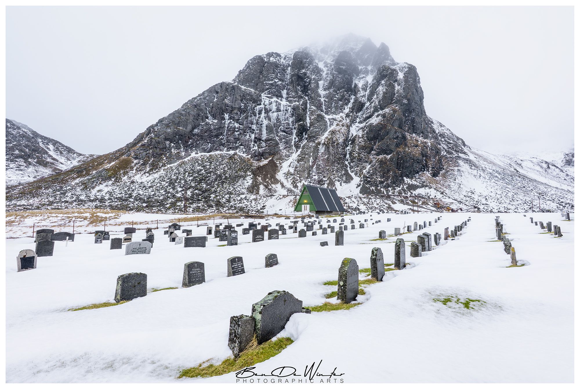

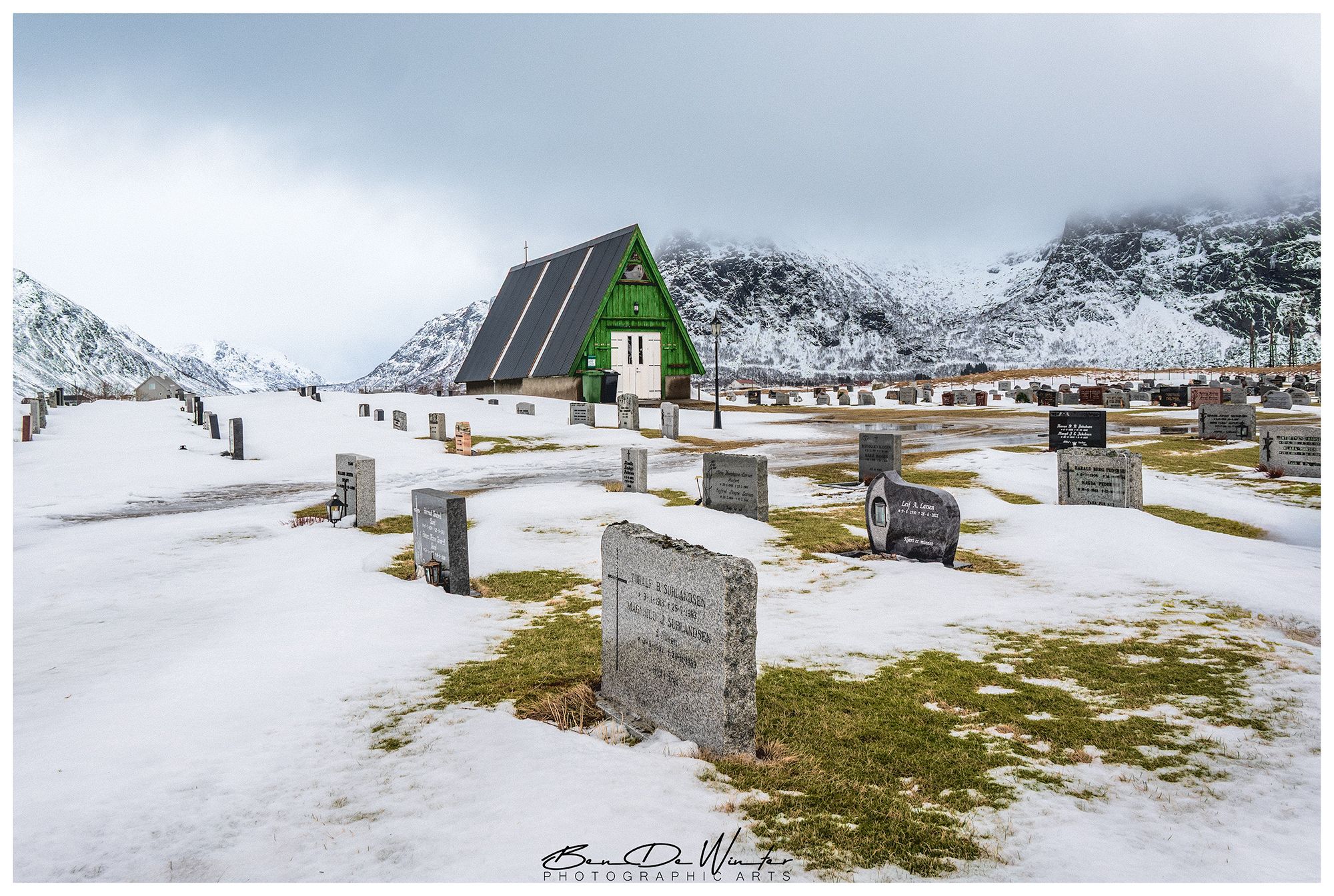
Norway Flakstad Cemetery
Flakstad Church and its cemetery are located in Ramberg, in the Flakstad Municipality of the Lofoten Islands, Norway. This site holds deep historical and cultural significance in the region.
Photography Tips
Embrace changing weather—clouds, snow, or mist can add atmosphere and contrast. A stormy sky behind the red church makes for a powerful composition.
The road leading to the church, the stone paths in the cemetery or the graves all can guide the viewer’s eye into the frame.
Use a wide-angle lens to capture the church with its mountainous backdrop.
Photographing the Cemetery
Respectful Composition: Avoid overly dramatic angles that might feel intrusive. Focus on the serenity and historical character.
Textures: Capture the moss-covered stones, inscriptions, and the contrast between old graves and the surrounding nature.
Seasonal Interest:
Winter: Snow-covered graves and frosty trees.
Summer: Wildflowers and green grass add life and color.
Travel Information
ocation
Address: Kjerkveien 26, 8380 Ramberg, Lofoten, Norway 1
Coordinates: Latitude 68.1051, Longitude 13.30116
By Car:
From Leknes (nearest town with an airport): ~33 km (about 30–40 minutes).
The drive offers scenic views along the E10 highway, which runs through the Lofoten archipelago.
By Public Transport:
Buses run between major towns like Leknes, Reine, and Å, with stops near Ramberg. Check local schedules via reisnordland.no.


Spot comments (0)