
United Kingdom Panoramic View from Beinn a'Chrulaiste
This is a typical hiker's spot but offers such an awesome view over the mountains of the Glen Coe area that you should get up there with a camera!
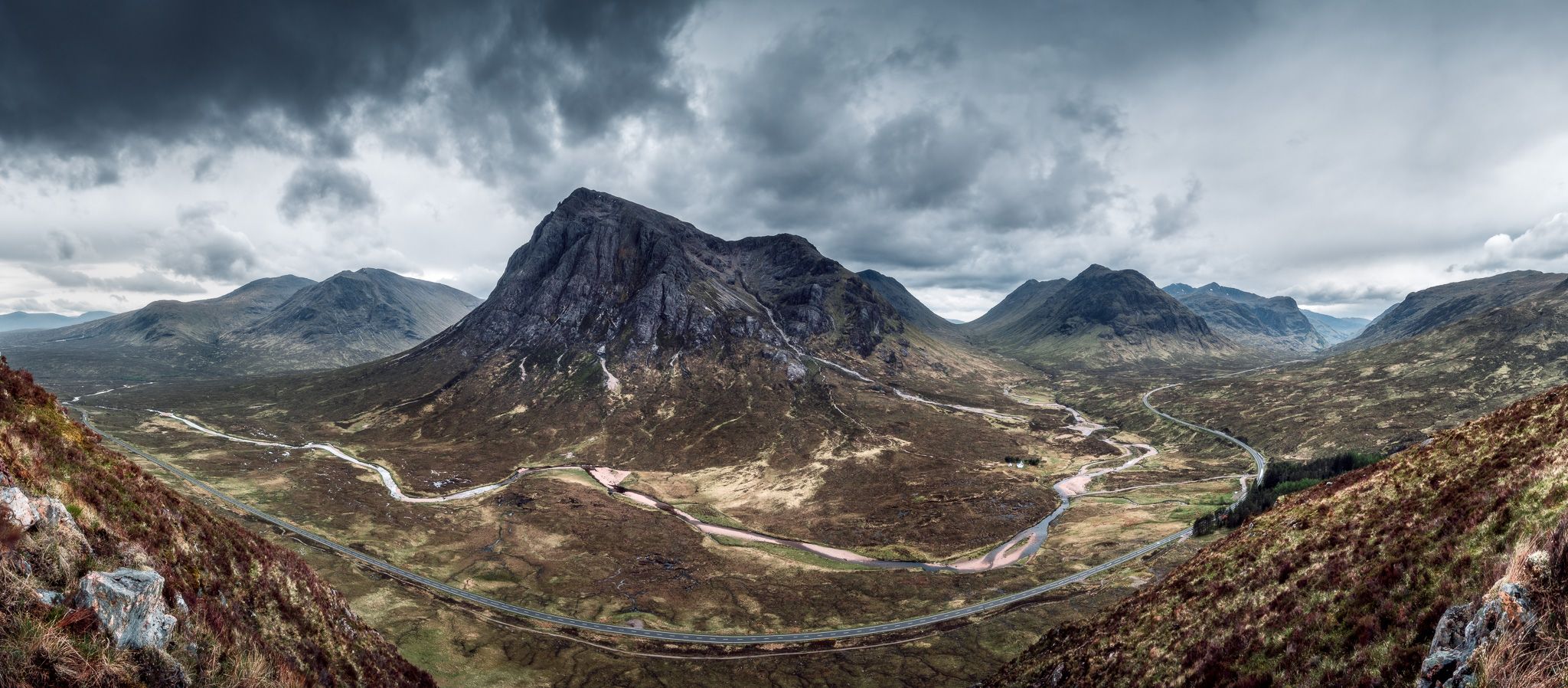
You will see the top of Buachaille Etive Mòr called Stob Dearg (1021m) its brother Buachaille Etive Beag with mountain tops Stob Coire Raineach (925m) and Stob Dubh (958m) and also the tip of the Three Sisters called Beinn Fhada (811m). On the left there's Black Mount with peaks Creise (1100m) and Meall a' Bhùiridh (1108m). River Coupall is meandering through those mountains.
You will see the top of Buachaille Etive Mòr called Stob Dearg (1021m) its brother Buachaille Etive Beag with mountain tops Stob Coire Raineach (925m) and Stob Dubh (958m) and also the tip of the Three Sisters called Beinn Fhada (811m). On the left there's Black Mount with peaks Creise (1100m) and Meall a' Bhùiridh (1108m). River Coupall is meandering through those mountains.
Photography Tips
Although you're up high you will have to get a lot of skies in your frame (those scottish clouds are so dramatic, you have to get them!). If you have, bring GND filters to balance dynamic range between skies and the dark mountains.
This should look much much better in winter with snowy mountain tops. Not sure though how hard it is to hike up there then.
This should look much much better in winter with snowy mountain tops. Not sure though how hard it is to hike up there then.
Travel Information
Put on waterproof hiking shoes as Glen Coe can be very boggy and you will have to hike a bit to get up to this view point. Warm and dry feet are a must... You can easily park at the marked spot.


Spot comments (5)