
USA Grizzly Falls
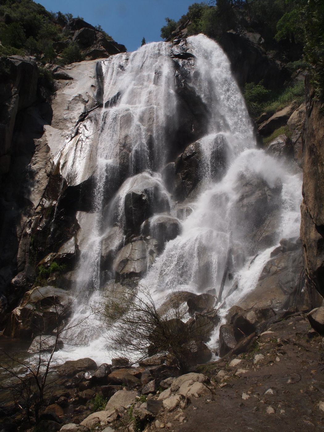
Between the Grant Grove and Cedar Grove sections of Kings Canyon National Park, California State Highway 180 passes through the Giant Sequoia National Monument, although you will see precious few giant sequoias along this stretch of highway (the individual groves are on dirt side roads or must be reached on foot….see descriptions for nearby spots closer to Grant Grove). This spot is the second “name brand” stop coming from Grant Grove after Boyden Cavern. Grizzly Falls is a beautiful waterfall that stands about 80 ft (24 m) tall and it has a modest pool at its base where some people cool off on a hot summer day.
After Boyden Cavern, Hwy 180 crosses to the north bank of the South Fork of the Kings River, then follows the river back into Kings Canyon National Park where more adventure awaits. Grizzly Falls is shown on the Cedar Grove Quadrangle (7.5’ topographic map) about 2.5 miles (4.0 km) west of the park boundary. The base of the waterfall is at an elevation of about 4,300 ft (1,310 m).
After Boyden Cavern, Hwy 180 crosses to the north bank of the South Fork of the Kings River, then follows the river back into Kings Canyon National Park where more adventure awaits. Grizzly Falls is shown on the Cedar Grove Quadrangle (7.5’ topographic map) about 2.5 miles (4.0 km) west of the park boundary. The base of the waterfall is at an elevation of about 4,300 ft (1,310 m).
Photography Tips
Grizzly Falls sits in south-facing alcove, so it’s in sunlight during the middle of the day. This image from mid-July a few years ago was made at 2:00 p.m. Early morning and late afternoon will find the waterfall in partial to full shadow.
There are two popular approaches to photographing rivers and waterfalls: short exposures to show power and turbulence (and even capture individual water drops) and long exposures to smooth out the water and create a more dreamy look. I use both techniques for rivers and waterfalls, often in back-to-back exposures. I suggest you try a variety of shutter speeds for Grizzly Falls. To use slow shutter speeds and get silky water, I suggest some combination of low ISO, and/or small aperture, and/or a neutral density filter. A polarizing filter is almost always useful outdoors to improve the image and to provide a modest neutral density effect.
Sierra Nevada waterfalls flow strongest from late winter through early summer, with the peak usually coming around mid-May. Grizzly Falls diminishes greatly by late summer. I have seen Grizzly Falls flow much more strongly than shown here and I have seen it narrowed down to a crest width of just a couple yards/meters.
Travel Information
From the Visitor Center in Grant Grove in Kings Canyon National Park, drive 24.5 miles (40.9 km) north/northeast/east and make a left-hand turn into the small parking lot for Grizzly Falls. At this spot you will find some picnic tables and a pit toilet. The path from the east end of the parking lot to the base of Grizzly Falls is just over 200 ft (60 m) long and the elevation gain is less than 20 ft (6 m). The path is not wheelchair accessible, but much of the waterfall can be seen from the parking lot.
In summer, Grizzly Falls always seems to have a few visitors in the middle of the day, and sometimes it gets as crowded as a dozen vehicles worth of people can make it. However, go early in the morning or late in the afternoon and you might have the waterfall all to yourself.
Grizzly Falls cannot be visited in the winter because the road to Cedar Grove is closed in the winter.
For more information about Grizzly Falls:
https://www.fs.usda.gov/recarea/sequoia/recarea/?recid=79509
https://www.hikespeak.com/trails/grizzly-falls-sequoia-national-forest/
https://californiathroughmylens.com/grizzly-falls-kings-canyon-national-park/
https://www.worldwaterfalldatabase.com/waterfall/Grizzly-Falls-7181
https://www.world-of-waterfalls.com/waterfalls/california-grizzly-falls/
For more information about the Giant Sequoia National Monument:
https://en.wikipedia.org/wiki/Giant_Sequoia_National_Monument
https://www.fs.usda.gov/detail/sequoia/home/?cid=stelprdb5394941
https://www.fs.usda.gov/visit/destination/giant-sequoia-national-monument-0
https://www.fs.usda.gov/main/sequoia/maps-pubs
https://www.nps.gov/seki/planyourvisit/maps.htm
For more information about the Kings River:
https://en.wikipedia.org/wiki/Kings_River_(California)
Spot Type
Outdoor
Crowd Factor
Just a few people
Best Timing
Daytime in spring
Sunrise & Sunset
05:50 - 20:12
| current local time: 23:06
Photo Themes
Waterfall


Spot comments (0)